
Powerful Storm Strikes Ireland and Scotland with Record Winds, Causing Widespread Disruptions
Storm Storn Éowyn Brings Hurricane-Force Winds, Power Outages, and Travel Chaos Across Ireland and Scotland

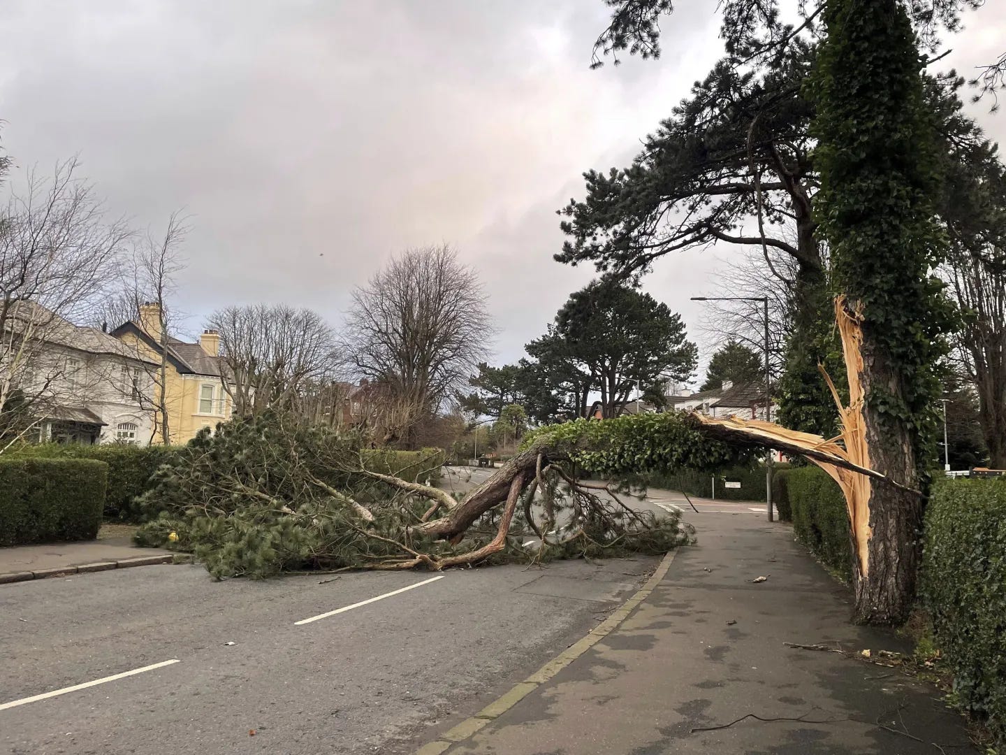
LONDON (AP) — Millions of residents in Ireland and northern parts of the United Kingdom were urged to remain indoors on Friday as a ferocious winter storm battered the region with hurricane-strength winds, knocking out power and grounding transportation.
Ireland experienced wind gusts of up to 114 miles (183 kilometers) per hour overnight, the highest since World War II, as a storm system named Storn Éowyn swept in from the Atlantic before hitting Scotland.
The intense weather forced widespread closures, including schools, and led to the cancellation of trains, ferries, and hundreds of flights across the Republic of Ireland, Northern Ireland, and Scotland.
A rare "red" weather warning, indicating danger to life, was issued for Friday across the entirety of Ireland and central and southwest Scotland.
"Please stay at home if possible," urged Northern Ireland First Minister Michelle O'Neill on BBC Radio Ulster. "We are in the eye of the storm. We are in the period of the red alert."
Scottish authorities also urged people to avoid travel, with the Scottish Parliament in Edinburgh closing its doors. Scottish First Minister John Swinney said, "We have to be clear: people should not travel."
The powerful storm knocked out electricity for more than 700,000 homes and businesses in Ireland and nearly 100,000 in Northern Ireland, causing what the Irish Electricity Supply Board described as "unprecedented, widespread, and extensive" damage to infrastructure.
Met Eireann, Ireland’s national weather service, recorded the 114-mile-an-hour gusts at Mace Head on the west coast, surpassing the previous record of 113 miles (182 kilometers) per hour set in 1945. The Met Office in the UK reported slightly lower wind speeds in Scotland, though they were still expected to be historically high.
The storm’s origins can be traced back to a weather system that also brought significant snowfall to the U.S. Gulf Coast, according to Jason Nicholls, lead international forecaster at AccuWeather.
The storm is being driven by the jet stream and energized by atmospheric conditions at higher altitudes. A dramatic drop in air pressure is expected to intensify the storm into a bomb cyclone, a phenomenon in which a storm’s pressure drops 24 millibars in 24 hours.
While it’s difficult to precisely attribute the effects of climate change on individual storms, experts agree that rising global temperatures due to human activity, such as the release of carbon dioxide and methane, are contributing to more extreme weather events.
"As the climate warms, we can expect these storms to become even more intense, with greater damages," said Hayley Fowler, a professor of climate change impacts at Newcastle University.